Checked
Langley Township parks directory
Langley Township, British Columbia, Canada
Find Langley Township, British Columbia parks and open spaces, with individual descriptions, recorded facilities, photos where verified and Google Maps.
Key information
Browse 191 park and open-space sections for Langley Township. Search a name, street or recorded feature, then open that place’s map. The source scope and any missing information are explained below.
On this page
What this directory covers
| Detail | Coverage |
|---|---|
| Individual sections | 191 |
| Source scope | All non-school and non-cemetery records from the Township of Langley Parks GIS layer, plus all 83 Parks and Amenities visitor listings. Langley City is outside this source. Includes unnamed greenway land and conceptual or unfinished sites. |
| Coverage limits | All entries in the stated source scope are included. This does not establish current public access. |
All non-school and non-cemetery records from the Township of Langley Parks GIS layer, plus all 83 Parks and Amenities visitor listings. Langley City is outside this source. Includes unnamed greenway land and conceptual or unfinished sites.
Recorded facilities can be seasonal, closed or out of service. A blank field means not confirmed. A map point may mark park land rather than a public or accessible entrance.
Sources: Langley Township official parks GIS inventory · Langley Township official visitor park listings · Township of Langley park-use rules
Find a park
Search the recorded names, streets, descriptions and facilities. Each result has its own section and map links. Only the places on the current page are downloaded.
Some pins mark park land rather than an entrance. Official park pages have current visiting details.
181 to 191 of 191 places
Williams Park
68 Avenue & 238 Street
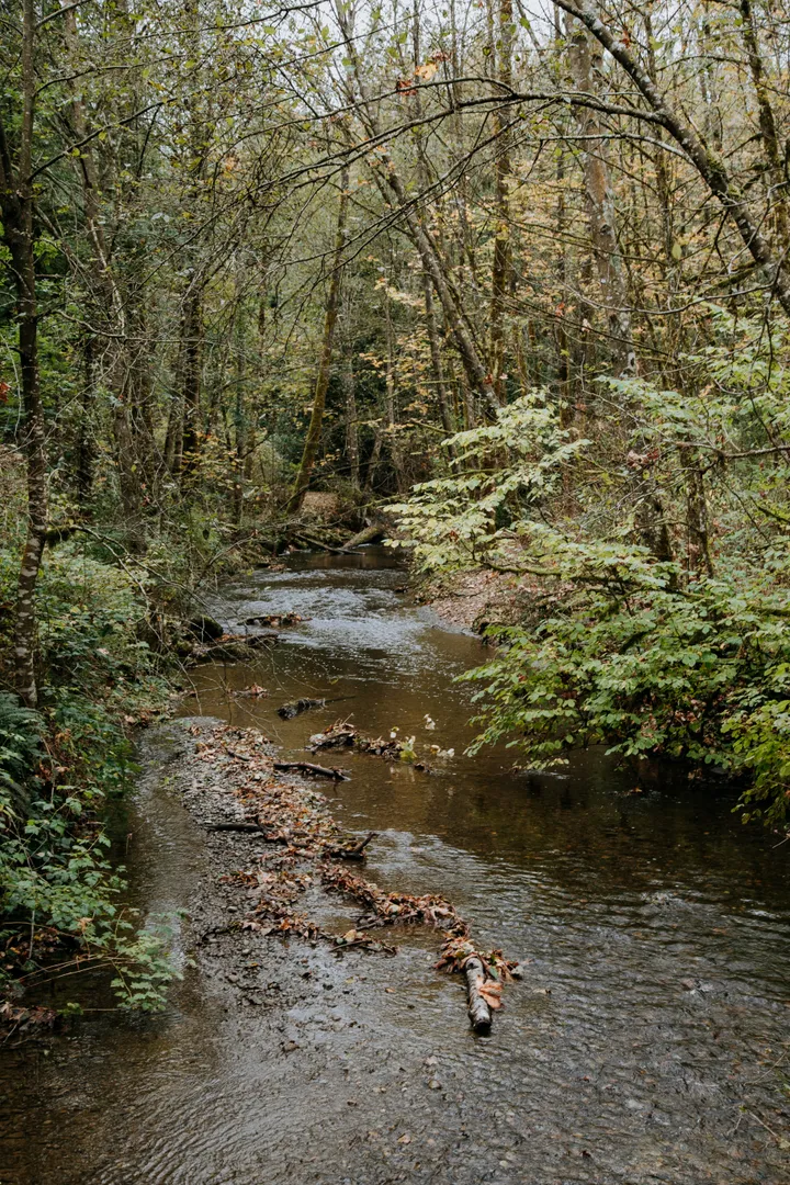
Williams Park is listed as a municipal park in Rural.
The official records list drinking water, forest, parking, passive area, picnic shelters, play area, restroom, trails, watercourse.
- Park type
- Municipal Park
- Area
- Rural
- Recorded status
- Complete
- Listed hours
- Dawn to Dusk Unless otherwise booked or special event
- Listed amenities
- Drinking Water, Forest, Parking, Passive Area, Picnic Shelters, Play Area, Restroom, Trails, Watercourse
- Visitor directory location
- Official facility map point
Sources: Langley Township official parks GIS inventory · Williams Park official facility details
Willoughby Community Park
7700 block 202A Street
Willoughby Community Park is listed as a community park in Willoughby.
The official records list amphitheatre, basketball, basketball (lighted), bocce, bocce (lighted), change rooms, detention pond, drinking water, lacrosse, lacrosse (lighted), meeting rooms, parking, pickleball, pickleball (lighted), picnic shelters, play area, restroom, rugby, rugby (lighted), sand volleyball, sand volleyball (lighted), soccer (lighted), spray park, stadium, stadium (lighted), synthetic fields (lighted), tennis.
- Park type
- Community Park
- Area
- Willoughby
- Recorded status
- Complete
- Listed hours
- Dawn to Dusk Unless otherwise booked or special event
- Listed amenities
- Amphitheatre, Basketball, Basketball (lighted), Bocce, Bocce (lighted), Change Rooms, Detention Pond, Drinking Water, Lacrosse, Lacrosse (lighted), Meeting Rooms, Parking, Pickleball, Pickleball (lighted), Picnic Shelters, Play Area, Restroom, Rugby, Rugby (lighted), Sand Volleyball, Sand Volleyball (lighted), Soccer (lighted), Spray Park, Stadium, Stadium (lighted), Synthetic Fields (lighted), Tennis
- Visitor directory location
- Official facility map point
Sources: Langley Township official parks GIS inventory · Willoughby Community Park official facility details
Willoughby Greenway
No street address in the source
Willoughby Greenway is listed as a greenway lot in Willoughby.
The land record does not list visitor amenities. Its land status does not confirm public access.
- Park type
- Greenway Lot
- Area
- Willoughby
- Recorded status
- Complete
Willowbrook Park
66 Avenue & 196 Street
Willowbrook Park is listed as a neighbourhood park in Willowbrook.
The official records list passive area, play area, trails.
- Park type
- Neighbourhood Park
- Area
- Willowbrook
- Recorded status
- Complete
- Listed hours
- Dawn to Dusk Unless otherwise booked or special event
- Listed amenities
- Passive Area, Play Area, Trails
- Visitor directory location
- Official facility map point
Sources: Langley Township official parks GIS inventory · Willowbrook Park official facility details
Wiser Natural Area
4100 196a St
Wiser Natural Area is listed in the Township visitor park directory.
The official records list brookswood-fernridge, forest.
- Recorded status
- Not recorded
- Listed hours
- Dawn to Dusk Unless otherwise booked or special event
- Listed amenities
- Brookswood-Fernridge, Forest
- Visitor directory location
- Official facility map point
Sources: Langley Township official parks GIS inventory · Wiser Natural Area official facility details
Wiser Natural Park
No street address in the source
Wiser Natural Park is listed as a special purpose park in Brookswood.
The land record does not list visitor amenities. Its land status does not confirm public access.
- Park type
- Special Purpose Park
- Area
- Brookswood
- Recorded status
- Complete
Woodland Drive Park
No street address in the source
Woodland Drive Park is listed as a neighbourhood park in Willowbrook.
The official records list passive area.
- Park type
- Neighbourhood Park
- Area
- Willowbrook
- Recorded status
- Complete
- Listed hours
- Dawn to Dusk Unless otherwise booked or special event
- Listed amenities
- Passive Area
- Visitor directory location
- Official facility map point
Sources: Langley Township official parks GIS inventory · Woodland Drive Park official facility details
Yeomans Heritage Parkette
96 Avenue & 208 Street
Yeomans Heritage Parkette is listed as a neighbourhood park in Walnut Grove.
The official records list heritage feature, plaza.
- Park type
- Neighbourhood Park
- Area
- Walnut Grove
- Recorded status
- Complete
- Listed hours
- Dawn to Dusk Unless otherwise booked or special event
- Listed amenities
- Heritage Feature, Plaza
- Visitor directory location
- Official facility map point
Sources: Langley Township official parks GIS inventory · Yeomans Heritage Parkette official facility details
Yorkson Community Park
84 Avenue & 206 Street
Yorkson Community Park is listed as a community park in Willoughby.
The official records list ball diamond, ball diamond (lighted), community garden, concession, detention pond, dog off-leash area, dog wash, drinking water, grass fields, parking, passive area, play area, pump track, restroom, soccer, spray park, synthetic fields (lighted), watercourse.
- Park type
- Community Park
- Area
- Willoughby
- Recorded status
- Complete
- Listed hours
- Dawn to Dusk Unless otherwise booked or special event
- Listed amenities
- Ball Diamond, Ball Diamond (lighted), Community Garden, Concession, Detention Pond, Dog Off-Leash Area, Dog Wash, Drinking Water, Grass Fields, Parking, Passive Area, Play Area, Pump track, Restroom, Soccer, Spray Park, Synthetic Fields (lighted), Watercourse
- Visitor directory location
- Official facility map point
Sources: Langley Township official parks GIS inventory · Yorkson Community Park official facility details
Yorkson Creek Greenway
No street address in the source
Yorkson Creek Greenway is listed as a greenway lot in Walnut Grove.
The land record does not list visitor amenities. Its land status does not confirm public access.
- Park type
- Greenway Lot
- Area
- Walnut Grove
- Recorded status
- Complete
Zazulak Park
No street address in the source
Zazulak Park is listed as a special purpose park in Brookswood.
The land record does not list visitor amenities. Its land status does not confirm public access.
- Park type
- Special Purpose Park
- Area
- Brookswood
- Recorded status
- Complete
Planning your park visit
Which parks and green spaces does this directory include?
All non-school and non-cemetery records from the Township of Langley Parks GIS layer, plus all 83 Parks and Amenities visitor listings. Langley City is outside this source. Includes unnamed greenway land and conceptual or unfinished sites.
How do I find a park near my home?
Find a name or address in the comparison table. Each place section has its own map and directions link. Unnamed land records use their source ID instead of an invented name.
Does this include parks in Langley City?
No. The inventory and visitor listings belong to the Township of Langley. Langley City is a separate local government.
Source: Township data and locations
Can I bring my dog to Township parks?
Dogs are welcome on a leash, but are not allowed on sports fields. Pick up dog waste immediately.
Which parks have designated off-leash areas?
The Township names Bertrand Creek Dog Park, Walnut Grove Off-Leash Park, Noel Booth Community Park, Old Yale Park, Routley Park and Yorkson Community Park.
Can I smoke or vape in Township parks?
No. Township parks are smoke-free. Tobacco, cannabis and e-cigarettes are prohibited.
What hours do the visitor park listings show?
Most visitor listings show dawn to dusk, with exceptions for booked use or special events. Each place section preserves its listed hours where available.
Does Complete in the GIS mean a park is open today?
No. Complete is a land-record status. It does not confirm today’s gates, washrooms, playing-field conditions or an accessible entrance.
Why are some greenway sites unnamed?
The source leaves their names blank. This directory keeps each source ID and mapped land position instead of inventing a destination name.
Are schools and cemeteries included as public parks?
No. Those 37 GIS records are excluded from the park directory and retained in the evidence ledger. School access depends on its operator.
Official park information
- Langley Township official parks GIS inventory
- Langley Township official visitor park listings
- Township of Langley park-use rules
Sources: Langley Township official parks GIS inventory · Langley Township official visitor park listings · Township of Langley park-use rules